Remote Sensing
What We Do
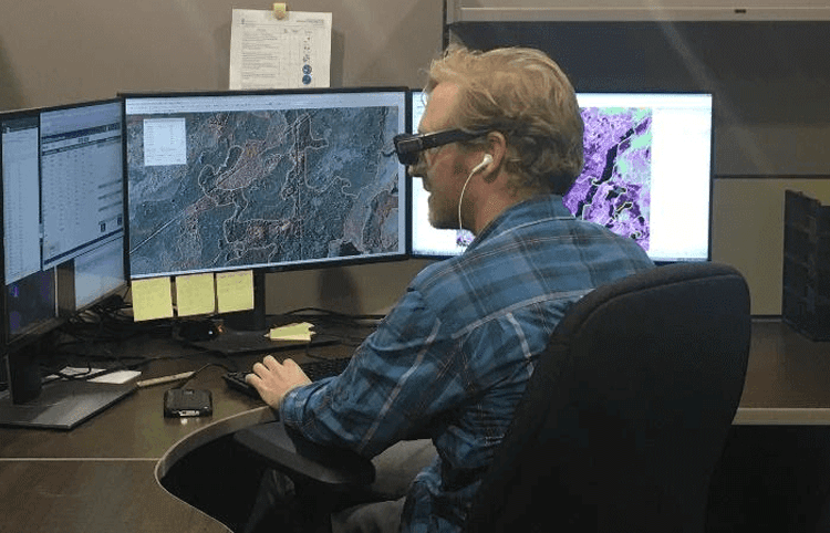
Our Remote Sensing team brings together advanced geospatial intelligence, applied geoAI, and deep sector expertise to help clients solve complex natural resource challenges with confidence. We partner closely with you to define project objectives, technical requirements, timelines, and budget parameters, then design and deliver a solution tailored to your operational and regulatory needs.
We understand the scale, scrutiny, and investment required for forest inventory and vegetation mapping programs. These initiatives demand precision, defensibility, and specialist expertise across remote sensing, forestry, GIS, analytics, and regulatory approval pathways. Our team is highly experienced in delivering technically robust programs that stand up to audit, support operational decision-making, and meet provincial standards.
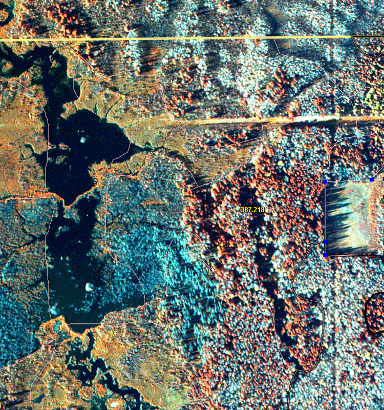
Recognized as an industry leader in forest inventory, we provide end-to-end support from project design and data acquisition through to analysis, deliverable production, and regulatory approval. Our multidisciplinary team includes some of Canada’s most experienced Photo Interpreters, Image Analysts, Project Managers, Forest Analysts, Forest Technicians, GIS Specialists, and GeoAI professionals.
From large-scale, multi-million-hectare vegetation inventory programs to targeted cut-block updates, disturbance assessments, and reforestation analysis, we have the capability, capacity, and quality systems to deliver at scale — on time and on budget.
If you require a fully integrated remote sensing solution, we offer support across the entire workflow, including imagery and LiDAR acquisition management, geospatial data model design, image analysis, photo interpretation, final deliverable assembly, and regulator engagement through to audit approval.
Whether you require a single service or a fully integrated suite of capabilities, you benefit from the collective expertise and insight of a team that combines field knowledge, spatial intelligence, and cutting-edge analytical methods.
If you’re seeking a trusted client-first with the expertise to deliver advanced remote sensing and geoAI solutions, we would welcome the opportunity to connect.
Remote Sensing Services
We deliver large-scale vegetation inventory programs with precision, consistency, and technical rigour, leveraging GeoAI, advanced analytics, automation, and machine learning:
- Alberta Vegetation Inventory (AVI)
- Enhanced Forest Inventories (EFI) that include a species classification
- Automated feature extraction
- Change detection
- Wetland inventories
- Ecosite classification
- Saskatchewan Forest Vegetation Inventory (SFVI)
- British Columbia Vegetation Resources Inventory (VRI)
- Primary Land and Vegetation Inventory (PLVI)
- Grassland Vegetation Inventory (GVI)
Let's Talk About Your Project
We keep your inventory up to date with timely and accurate annual anthropogenic updates and effective assessment work reducing the need for expensive boots on the ground activities:
- Annual cutblock updates
- Anthropogenic and linear disturbance updates
- Reforestation Standard of Alberta (RSA) - establishment and performance assessments
- Aerial vegetation assessments
Let's Talk About Your Project
We have heavily invested in operational research to advance the science and application of automated classification techniques and advanced analytics of various sources of imagery and LiDAR:
- Automated feature extraction
- Delineation and classification of industrial footprint
- Change detection
- Vegetation Health
- Carbon Assessments
- Water and Wetlands
Let's Talk About Your Project
Why Choose Our Remote Sensing Team
Stringent Quality Control Procedures
We are known throughout the industry for the quality of our inventory products and our effectiveness at receiving regulatory approvals
Industry Leader in Forest Inventory
We have one of the largest remote sensing teams and longest histories providing high-quality inventory services in Canada
Government Policy Requirements
We are experts in environmental regulation and have developed a collaborative approach to engaging regulators during the planning process
Innovative and Cost-Effective Solutions
We are driven to find innovative ways to complete your project for less money
Testimonials
"Silvacom helped us complete two state-of-the-art AVIs. The quality surpassed anything that we have had before and I’m very proud of the work that the Silvacom team accomplished. 2.7 million ha of high-quality interpretation was completed on-time and on-budget. Truly impressive."
Gordon Whitmore, Mercer International
"I’ve represented clients for whom Silvacom has worked for close to 30 years. What has always stood out to me is their attention to detail and commitment to understanding and providing what the customer wants."
Greg Branton, Consultant
We find the best and keep the best, so our clients
always get the best!
Join our highly engaged, experienced and passionate team of resource professionals
Silvacom (head office)
201 - 4723 52 Ave NW
Edmonton
Alberta, T6B 3R6
Canada